

The complete geography package comes to us in a Google Earth mashup from Herff Jones. The Stratalogica team is doing their part to get us out of the 1987 classroom from Summer School by offering a wide range of interactive maps, atlases, charts, globes, and more using the Earth API. These resources are up to date and relative so you don't have to tell your students that it isn't called the Soviet Union anymore. In fact, they have already updated the system to show the new Republic of South Sudan which is only a little over a week old at the time of this post. Sure it costs money but a lot less than one of those pull down maps for the front of the room and if you bought one of those 3 weeks ago it would be outdated. And the springs probably broke already. And try putting a digital overlay of the Silk Road on one of those. Seriously, stop buying those, Kotter. Even better, the social media team was the coolest crew at ISTE and they love Twitter so message them at @Stratalogica, @DonRescigno, and @kirstaw.
I believe that authentic global competence includes a strong command of the local community as well. This resource allows you to select a decade to view historical borders of the counties around your area. Zoom in for more detail to have powerful geography discussion with students. Bonus: There is also the world boundaries map that offers the same features on a global scale.
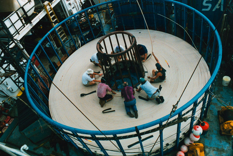
I have always been fascinated by the size of the cable ships that lay oceanic communication lines. When I was in the classroom I often shared this process and its painstakingly slow process with Media Technology students - this map would have been a big help. Here you can not only see all of the underwater lines but also see the bandwidth, length, names, and more data on each of the lines. Discussion could range from how financial transactions happen in seconds between Europe and the US to how French Polynesia gets internet connectivity. Share this with every tech geek you know.
If you are creating genealogy projects with students then you have to use this. HistoryPin allows you to "pin" your old photos to places and locations in a Maps mashup. You can contribute the historical image archiving of the world and give others a chance to see it, comment on it, and share it. This gem is developed and delivered by the non-profit organization We Are What We Do. This team can be found on Twitter at @HistoryPin.
Additional Resource
For more on Google Maps mashups you have to check out the Google Maps Mania Blog and 50 Things To Do With Google Mashups.
Perfect post. Here’s a tool that helps create Map Mashup providing a step-by-step wizard that generates ready-to-deploy code on any website or blog http://blog.caspio.com/integration/announcing-the-new-and-improved-map-mashup-version-7/
ReplyDelete